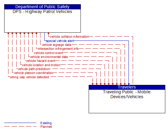
Interface: DPS - Highway Patrol Vehicles - Traveling Public - Mobile Devices/Vehicles
Architecture Flow Definitions
intersection infringement info (Planned)
Vehicle path information sent by a vehicle that is violating the stop bar at an intersection. This flow includes the vehicle's position, heading, speed, acceleration, transmission, steering–wheel angle, braking status, size information and trajectory.
special vehicle alert (Existing) Applicable ITS Standards
Notification that a vehicle is in the vicinity that requires special attention from drivers. In this context, 'special vehicle' refers to any type of vehicle that uses lights or placards to alert drivers including public safety vehicles, oversize vehicles, slow vehicles, and service vehicles that stop and back up frequently.
vehicle collision information (Planned) Applicable ITS Standards
The current status of the vehicle systems following a collision including air bag deployment, number of passengers, seat belt usage, sensor data that indicates crash severity (e.g., Delta V speed profile during the crash, vehicle damage, number of impacts), and vehicle type/make/model.
vehicle control event (Planned)
Notification that the vehicle has performed an emergency action that could impact the safety of surrounding vehicles. This includes hard braking and activation of traction/stability control systems or other actions that warrant immediate notification of surrounding vehicles. The information flow conveys the vehicle's position, heading, speed, acceleration, transmission, steering wheel angle, braking status, size information, and trajectory.
vehicle environmental data (Planned)
Data from vehicle safety and convenience systems that can be used to estimate environmental and infrastructure conditions, including measured air temperature, exterior light status, wiper status, sun sensor status, rain sensor status, traction control status, anti–lock brake status, vertical acceleration and other collected vehicle system status and sensor information. The collected data is reported along with the location, heading, and time that the data was collected. Both current data and snapshots of recent events (e.g., traction control or anti–lock brake system activations) may be reported.
vehicle hazard event (Planned)
Notification of a potential hazard that is detected by the vehicle, including hazards posed by the vehicle itself. Self–reported hazards include notification that the vehicle is being operated in an unsafe manner or is stopped in the travel lanes or on the shoulder. Detected hazards include unequipped vehicles operating unsafely, traffic queues, and foreign objects (people, animals, debris, other obstacles) in the travel lanes. It includes vehicle location and status, path, current control actions, and additional information on the detected hazard, if applicable.
vehicle location and motion (Planned) Applicable ITS Standards
Data describing the vehicle's position, heading, speed, acceleration, transmission, steering wheel angle, braking status, size information, and trajectory.
vehicle path prediction (Planned)
The predicted future vehicle path of travel. This flow includes an indication of the future positions of the transmitting vehicle that can be used by receiving vehicles to support coordinated driving manuevers and enhance in–lane and out–of–lane threat classification.
vehicle platoon coordination (Planned)
Coordination of control commands between leader and follower vehicles allowing vehicles to join, coordinate with, and separate from platoons of cooperative vehicles. This flow shares platoon size, location, and performance parameters (e.g., platoon speed and spacing) between platooned vehicles. It also coordinates maneuvers between platooned vehicles, including maneuvers as vehicles join and leave the platoon.
vehicle signage data (Planned) Applicable ITS Standards
In–vehicle signing data that augments regulatory, warning, and informational road signs and signals. The information provided would include static sign information (e.g., stop, curve warning, guide signs, service signs, and directional signs) and dynamic information (e.g., current signal states, grade crossing information, local traffic and road conditions, detours, advisories, and warnings).
wrong way vehicle detected (Planned)
Notification that a vehicle has been detected traveling in the wrong direction. This can be a direct report by an equipped vehicle that is being driven in the wrong direction or a report of a non–equipped vehicle that has been detected traveling in the wrong direction. It includes the current location, speed, acceleration, and heading of the wrong way vehicle.