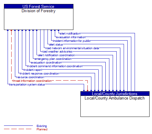
Interface: Division of Forestry - Local/County Ambulance Dispatch
Architecture Flow Definitions
alert notification (Existing) Applicable ITS Standards
Notification of a major emergency such as a natural or man–made disaster, civil emergency, or child abduction for distribution to the public. The flow identifies the alert originator, the nature of the emergency, the geographic area affected by the emergency, the effective time period, and information and instructions necessary for the public to respond to the alert. This flow may also identify specific information that should not be released to the public.
alert notification coordination (Existing)
Coordination of emergency alerts to be distributed to the public. This includes notification of a major emergency such as a natural or man–made disaster, civil emergency, or child abduction for distribution to the public and status of the public notification.
alert status (Existing) Applicable ITS Standards
Information indicating the current status of the emergency alert including identification of the traveler and driver information systems that are being used to provide the alert.
emergency plan coordination (Existing)
Information that supports coordination of emergency management plans, continuity of operations plans, emergency response and recovery plans, evacuation plans, and other emergency plans between agencies. This includes general plans that are coordinated prior to an incident and shorter duration tactical plans that are prepared during an incident.
evacuation coordination (Existing)
Coordination of information regarding a pending or in–process evacuation. Includes evacuation zones, evacuation times, evacuation routes, forecast network conditions, and reentry times.
evacuation information (Existing) Applicable ITS Standards
Evacuation instructions and information including evacuation zones, evacuation times, and reentry times.
incident command information coordination (Existing)
Information that supports local management of an incident. It includes resource deployment status, hazardous material information, traffic, road, and weather conditions, evacuation advice, and other information that enables emergency or maintenance personnel in the field to implement an effective, safe incident response.
incident information for public (Existing) Applicable ITS Standards
Report of current desensitized incident information prepared for public dissemination.
incident report (Existing)
Report of an identified incident including incident location, type, severity and other information necessary to initiate an appropriate incident response.
incident response coordination (Existing)
Incident response procedures and current incident response status that are shared between allied response agencies to support a coordinated response to incidents. This flow provides current situation information, including a summary of incident status and its impact on the transportation system and other infrastructure, and current and planned response activities. This flow also coordinates a positive hand off of responsibility for all or part of an incident response between agencies.
resource coordination (Existing)
Coordination of resource inventory information, specific resource status information, resource prioritization and reallocation between jurisdictions, and specific requests for resources and responses that service those requests.
road network environmental situation data (Existing) Applicable ITS Standards
Aggregated environmental situation data collected from vehicles and other sources for the road network. Aggregated information would include measured air temperature, exterior light status, wiper status, sun sensor status, rain sensor status, traction control status, ALB status, and other collected vehicle system status and sensor information for the region.
road weather advisories (Existing) Applicable ITS Standards
Segment–specific weather and road conditions including real–time advisories of deteriorating road and weather conditions, medium–term advisories for the next 2–12 hours, and long–term advisories more than 12 hours into the future. The advisories may include advisories that are issued by the RSE based on locally collected environmental data (e.g., an ice on bridge advisory).
threat information coordination (Planned)
Sensor, surveillance, and threat data including raw and processed data that is collected by sensor and surveillance equipment located in secure areas.
transportation system status (Existing) Applicable ITS Standards
Current status and condition of transportation infrastructure (e.g., tunnels, bridges, interchanges, TMC offices, maintenance facilities). In case of disaster or major incident, this flow provides an assessment of damage sustained by the surface transportation system including location and extent of the damage, estimate of remaining capacity and necessary restrictions, and time frame for repair and recovery.