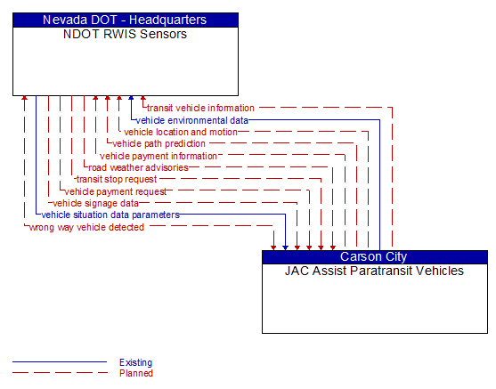
Interface: NDOT RWIS Sensors - JAC Assist Paratransit Vehicles
Architecture Flow Definitions
road weather advisories (Planned) Applicable ITS Standards
Segment–specific weather and road conditions including real–time advisories of deteriorating road and weather conditions, medium–term advisories for the next 2–12 hours, and long–term advisories more than 12 hours into the future. The advisories may include advisories that are issued by the RSE based on locally collected environmental data (e.g., an ice on bridge advisory).
transit stop request (Planned) Applicable ITS Standards
Notification that a transit stop has been requested by a transit user at a roadside stop. This flow identifies the route, stop, and the time of the request.
transit vehicle information (Planned) Applicable ITS Standards
Information about the transit vehicle route and stops, including current location along the route and next stop.
vehicle environmental data (Existing) Applicable ITS Standards
Data from vehicle safety and convenience systems that can be used to estimate environmental and infrastructure conditions, including measured air temperature, exterior light status, wiper status, sun sensor status, rain sensor status, traction control status, anti–lock brake status, vertical acceleration and other collected vehicle system status and sensor information. The collected data is reported along with the location, heading, and time that the data was collected. Both current data and snapshots of recent events (e.g., traction control or anti–lock brake system activations) may be reported.
vehicle location and motion (Planned) Applicable ITS Standards
Data describing the vehicle's position, heading, speed, acceleration, transmission, steering wheel angle, braking status, size information, and trajectory.
vehicle path prediction (Planned) Applicable ITS Standards
The predicted future vehicle path of travel. This flow includes an indication of the future positions of the transmitting vehicle that can be used by receiving vehicles to support coordinated driving manuevers and enhance in–lane and out–of–lane threat classification.
vehicle payment information (Planned) Applicable ITS Standards
Information provided for payment of tolls, parking, and other transportation fees including identification that can be used to identify the payment account or source and related vehicle and service information that are used to determine the type and price of service requested. The information exchange normally supports an account debit to pay fees, but an account credit may be initiated where pricing strategies include incentives.
vehicle payment request (Planned) Applicable ITS Standards
Request for information supporting payments. For fee structures that include incentives, the request may support either an account debit or an account credit or reimbursement.
vehicle signage data (Planned) Applicable ITS Standards
In–vehicle signing data that augments regulatory, warning, and informational road signs and signals. The information provided would include static sign information (e.g., stop, curve warning, guide signs, service signs, and directional signs) and dynamic information (e.g., current signal states, grade crossing information, local traffic and road conditions, detours, advisories, and warnings).
vehicle situation data parameters (Existing) Applicable ITS Standards
A request for vehicle situation data that includes parameters used to control the data that is reported and the flow of data reported by the vehicle. This flow identifies the type of data/snapshots that are requested and reporting parameters such as snapshot frequency, filtering criteria (data thresholds for reporting), and reporting interval.
wrong way vehicle detected (Planned) Applicable ITS Standards
Notification that a vehicle has been detected traveling in the wrong direction. This can be a direct report by an equipped vehicle that is being driven in the wrong direction or a report of a non–equipped vehicle that has been detected traveling in the wrong direction. It includes the current location, speed, acceleration, and heading of the wrong way vehicle.