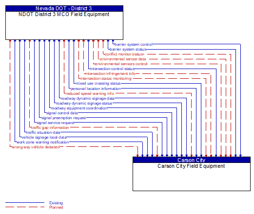
Interface: NDOT District 3 MCO Field Equipment - Carson City Field Equipment
Architecture Flow Definitions
barrier system control (Existing) Applicable ITS Standards
Information used to configure and control barrier systems that are represented by gates, barriers and other automated or remotely controlled systems used to manage entry to roadways.
barrier system status (Existing) Applicable ITS Standards
Current operating status of barrier systems. Barrier systems represent gates, barriers and other automated or remotely controlled systems used to manage entry to roadways. Status of the systems includes operating condition and current operational state.
conflict monitor status (Planned) Applicable ITS Standards
A control flow that supports failsafe operation in the event that a conflict is detected that requires the RSE to enter a failsafe operating mode.
environmental sensor data (Planned) Applicable ITS Standards
Current road conditions (e.g., surface temperature, subsurface temperature, moisture, icing, treatment status) and surface weather conditions (e.g., air temperature, wind speed, precipitation, visibility) as measured and reported by fixed and/or mobile environmental sensors. Operational status of the sensors is also included.
environmental sensors control (Planned) Applicable ITS Standards
Data used to configure and control environmental sensors.
intersection control status (Existing) Applicable ITS Standards
Status data provided by the traffic signal controller including phase information, alarm status, and priority/preempt status.
intersection infringement info (Planned) Applicable ITS Standards
Vehicle path information sent by a vehicle that is violating the stop bar at an intersection. This flow includes the vehicle's position, heading, speed, acceleration, transmission, steering–wheel angle, braking status, size information and trajectory.
intersection status monitoring (Planned) Applicable ITS Standards
Current signal phase and timing information for all lanes at a signalized intersection. This flow represents monitoring of communications by a receiver at the intersection to support monitoring for conflicts between actual signal states and RSE communications about those states.
mixed use crossing status (Existing) Applicable ITS Standards
Current pedestrian and other mixed use crossing information including an indication of whether the call button has been activated, the current state of the mixed use crossing signal, and information indicating whether non–motorized users are currently occupying the cross walk.
personal location information (Existing) Applicable ITS Standards
Pedestrian, bicyclist, and other non–motorized user locations at an intersection as detected and reported by an RSE.
reduced speed warning info (Planned) Applicable ITS Standards
Real time notification of vehicle detections, measured vehicle characteristics (e.g., vehicle height), speed measurements, and warnings issued by roadway infrastructure. This flow can also include roadway configuration data, current speed limits, and warning parameters and thresholds enabling local speed management application configuration and management.
roadway dynamic signage data (Existing) Applicable ITS Standards
Information used to initialize, configure, and control dynamic message signs. This flow can provide message content and delivery attributes, local message store maintenance requests, control mode commands, status queries, and all other commands and associated parameters that support remote management of these systems.
roadway dynamic signage status (Existing) Applicable ITS Standards
Current operating status of dynamic message signs, highway advisory radios, or other configurable field equipment that provides dynamic information to the driver.
roadway equipment coordination (Existing)
The direct flow of information between field equipment. This includes transfer of information between sensors and driver information systems (e.g., DMS, HAR, variable speed limit signs, dynamic lane signs) or control devices (e.g., traffic signals, ramp meters), direct coordination between adjacent control devices, interfaces between detection and warning or alarm systems, and any other direct communications between field equipment.
signal control data (Existing)
Information used to configure local traffic signal controllers.
signal preemption request (Existing) Applicable ITS Standards
Direct request for preemption to a traffic signal controller that results in preemption of the current control plan and grants right–of–way to the requesting vehicle. This flow identifies the required phase and timing of the preemption. This flow may also cancel the preemption request (e.g., when the requesting vehicle clears the intersection).
signal service request (Existing) Applicable ITS Standards
A call for service or extension for a signal control phase that is issued by the RSE for connected vehicles approaching an intersection and/or pedestrians at a crosswalk. This flow identifies the desired phase and service time.
traffic gap information (Planned) Applicable ITS Standards
Measured gap to the next approaching vehicle per lane and direction of travel
traffic situation data (Existing) Applicable ITS Standards
Current, aggregate traffic data collected from connected vehicles that can be used to supplement or replace information collected by roadside traffic detectors. It includes raw and/or processed reported vehicle speeds, counts, and other derived measures. Raw and/or filtered vehicle control events may also be included to support incident detection.
vehicle signage local data (Existing) Applicable ITS Standards
Information provided by adjacent field equipment to support in–vehicle signing of dynamic information that is currently being displayed to passing drivers. This includes the dynamic information (e.g., current signal states, grade crossing information, local traffic and road conditions, detours, advisories, parking availability, etc.) and control parameters that identify the desired timing, duration, and priority of the signage data.
work zone warning notification (Existing) Applicable ITS Standards
Notification of a work zone emergency or safety issue. This flow identifies that a work zone emergency or safety issue has occurred so that warnings may be generated by more than one system in the work zone.
wrong way vehicle detected (Planned)
Notification that a vehicle has been detected traveling in the wrong direction. This can be a direct report by an equipped vehicle that is being driven in the wrong direction or a report of a non–equipped vehicle that has been detected traveling in the wrong direction. It includes the current location, speed, acceleration, and heading of the wrong way vehicle.