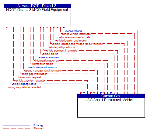
Interface: NDOT District 3 MCO Field Equipment - JAC Assist Paratransit Vehicles
Architecture Flow Definitions
access permission (Existing) Applicable ITS Standards
Information returned indicating whether permission for access is granted and instructions for proceeding.
access request (Existing) Applicable ITS Standards
Request for access to an access–controlled transportation facility.
intersection geometry (Planned) Applicable ITS Standards
The physical geometry of an intersection covering the location and width of each approaching lane, egress lane, and valid paths between approaches and egresses. This flow also defines the location of stop lines, cross walks, specific traffic law restrictions for the intersection (e.g., turning movement restrictions), and other elements that support calculation of a safe and legal vehicle path through the intersection.
intersection status (Planned) Applicable ITS Standards
Current signal phase and timing information for all lanes at a signalized intersection. This flow identifies active lanes and lanes that are being stopped and specifies the length of time that the current state will persist for each lane. It also identifies signal priority and preemption status and pedestrian crossing status information where applicable.
road closure information (Existing) Applicable ITS Standards
Road closure information provided to passing vehicles. This flow provides information about the road closure with diversion information.
speed management information (Planned) Applicable ITS Standards
Target speeds, speed advisories, and/or speed limit information provided to a vehicle. The information includes the current speed value(s), the route segment(s) and lane(s) where the speeds apply, and an indication of whether the speeds are suggested target speeds, posted advisory speeds, or enforceable speed limit values. This flow may also include information about the reason for reduced speeds and provide target lane information if lane changes are required.
traffic gap information (Planned) Applicable ITS Standards
Measured gap to the next approaching vehicle per lane and direction of travel
transit stop request (Planned) Applicable ITS Standards
Notification that a transit stop has been requested by a transit user at a roadside stop. This flow identifies the route, stop, and the time of the request.
transit vehicle information (Planned) Applicable ITS Standards
Information about the transit vehicle route and stops, including current location along the route and next stop.
vehicle environmental data (Planned) Applicable ITS Standards
Data from vehicle safety and convenience systems that can be used to estimate environmental and infrastructure conditions, including measured air temperature, exterior light status, wiper status, sun sensor status, rain sensor status, traction control status, anti–lock brake status, vertical acceleration and other collected vehicle system status and sensor information. The collected data is reported along with the location, heading, and time that the data was collected. Both current data and snapshots of recent events (e.g., traction control or anti–lock brake system activations) may be reported.
vehicle location and motion (Planned) Applicable ITS Standards
Data describing the vehicle's position, heading, speed, acceleration, transmission, steering wheel angle, braking status, size information, and trajectory.
vehicle location and motion for surveillance (Planned) Applicable ITS Standards
Data describing the vehicle's position, heading, speed, acceleration, transmission, steering wheel angle, braking status, size information, and trajectory. This flow represents monitoring of basic safety data ('vehicle location and motion') broadcast by passing connected vehicles for use in vehicle detection and traffic monitoring applications.
vehicle path prediction (Planned) Applicable ITS Standards
The predicted future vehicle path of travel. This flow includes an indication of the future positions of the transmitting vehicle that can be used by receiving vehicles to support coordinated driving manuevers and enhance in–lane and out–of–lane threat classification.
vehicle payment information (Planned) Applicable ITS Standards
Information provided for payment of tolls, parking, and other transportation fees including identification that can be used to identify the payment account or source and related vehicle and service information that are used to determine the type and price of service requested. The information exchange normally supports an account debit to pay fees, but an account credit may be initiated where pricing strategies include incentives.
vehicle payment request (Planned) Applicable ITS Standards
Request for information supporting payments. For fee structures that include incentives, the request may support either an account debit or an account credit or reimbursement.
vehicle profile (Planned) Applicable ITS Standards
Information about a vehicle such as vehicle make and model, fuel type, engine type, size and weight, vehicle performance and level of control automation, average emissions, average fuel consumption, passenger occupancy, or other data that can be used to classify vehicle eligibility for access to specific lanes, road segments, or regions or participation in cooperative vehicle control applications.
vehicle signage data (Existing) Applicable ITS Standards
In–vehicle signing data that augments regulatory, warning, and informational road signs and signals. The information provided would include static sign information (e.g., stop, curve warning, guide signs, service signs, and directional signs) and dynamic information (e.g., current signal states, grade crossing information, local traffic and road conditions, detours, advisories, and warnings).
wrong way vehicle detected (Planned) Applicable ITS Standards
Notification that a vehicle has been detected traveling in the wrong direction. This can be a direct report by an equipped vehicle that is being driven in the wrong direction or a report of a non–equipped vehicle that has been detected traveling in the wrong direction. It includes the current location, speed, acceleration, and heading of the wrong way vehicle.