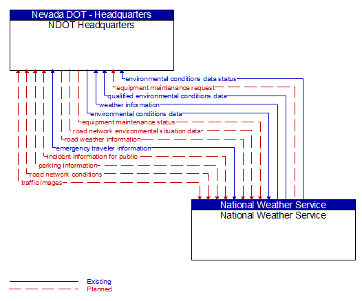
Interface: NDOT Headquarters - National Weather Service
Architecture Flow Definitions
emergency traveler information (Existing) Applicable ITS Standards
Public notification of an emergency such as a natural or man–made disaster, civil emergency, or child abduction. This flow also includes evacuation information including evacuation instructions, evacuation zones, recommended evacuation times, tailored evacuation routes and destinations, traffic and road conditions along the evacuation routes, traveler services and shelter information, and reentry times and instructions.
environmental conditions data (Existing) Applicable ITS Standards
Current road conditions (e.g., surface temperature, subsurface temperature, moisture, icing, treatment status) and surface weather conditions (e.g., air temperature, wind speed, precipitation, visibility) as measured and reported by fixed and/or mobile environmental sensors and aggregated by the data collector. Attributes relating to the data collection (and aggregation) are also included.
environmental conditions data status (Existing) Applicable ITS Standards
Status of the data quality of environmental conditions data provided by a data contributor. Includes not only status by sensor, but statistical data regarding the quality checking of data provided.
equipment maintenance request (Planned) Applicable ITS Standards
Identification of field equipment requiring repair and known information about the associated faults.
equipment maintenance status (Planned) Applicable ITS Standards
Current status of field equipment maintenance actions.
incident information for public (Planned) Applicable ITS Standards
Report of current desensitized incident information prepared for public dissemination.
parking information (Planned) Applicable ITS Standards
General parking information and status, including current parking availability.
qualified environmental conditions data (Existing) Applicable ITS Standards
Current road conditions (e.g., surface temperature, subsurface temperature, moisture, icing, treatment status) and surface weather conditions (e.g., air temperature, wind speed, precipitation, visibility) that has had quality checks performed on it and has been formatted and consolidated by the Clarus system. Attributes relating to the data collection (and aggregation) are also included.
road network conditions (Planned) Applicable ITS Standards
Current and forecasted traffic information, road and weather conditions, and other road network status. Either raw data, processed data, or some combination of both may be provided by this flow. Information on diversions and alternate routes, closures, and special traffic restrictions (lane/shoulder use, weight restrictions, width restrictions, HOV requirements) in effect is included.
road network environmental situation data (Planned) Applicable ITS Standards
Aggregated environmental situation data collected from vehicles and other sources for the road network. Aggregated information would include measured air temperature, exterior light status, wiper status, sun sensor status, rain sensor status, traction control status, ALB status, and other collected vehicle system status and sensor information for the region.
road weather information (Planned) Applicable ITS Standards
Road conditions and weather information that are made available by road maintenance operations to other transportation system operators.
traffic images (Planned) Applicable ITS Standards
High fidelity, real–time traffic images suitable for surveillance monitoring by the operator or for use in machine vision applications. This flow includes the images and meta data that describes the images.
weather information (Existing) Applicable ITS Standards
Accumulated forecasted and current weather data (e.g., temperature, pressure, wind speed, wind direction, humidity, precipitation, visibility, light conditions, etc.).