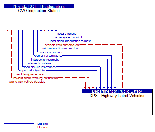
Interface: CVO Inspection Station - DPS - Highway Patrol Vehicles
Architecture Flow Definitions
access permission (Existing) Applicable ITS Standards
Information returned indicating whether permission for access is granted and instructions for proceeding.
access request (Existing) Applicable ITS Standards
Request for access to an access–controlled transportation facility.
barrier system control (Existing) Applicable ITS Standards
Information used to configure and control barrier systems that are represented by gates, barriers and other automated or remotely controlled systems used to manage entry to roadways.
barrier system status (Existing) Applicable ITS Standards
Current operating status of barrier systems. Barrier systems represent gates, barriers and other automated or remotely controlled systems used to manage entry to roadways. Status of the systems includes operating condition and current operational state.
incident scene warning notification (Planned) Applicable ITS Standards
Notification of an incident scene emergency or safety issue. This flow identifies that an incident scene emergency or safety issue has occurred so that warnings may be generated by more than one system in the work zone.
intersection geometry (Existing) Applicable ITS Standards
The physical geometry of an intersection covering the location and width of each approaching lane, egress lane, and valid paths between approaches and egresses. This flow also defines the location of stop lines, cross walks, specific traffic law restrictions for the intersection (e.g., turning movement restrictions), and other elements that support calculation of a safe and legal vehicle path through the intersection.
intersection status (Existing) Applicable ITS Standards
Current signal phase and timing information for all lanes at a signalized intersection. This flow identifies active lanes and lanes that are being stopped and specifies the length of time that the current state will persist for each lane. It also identifies signal priority and preemption status and pedestrian crossing status information where applicable.
local signal preemption request (Existing) Applicable ITS Standards
Direct control signal or message to a signalized intersection that results in preemption of the current control plan and grants right–of–way to the requesting vehicle.
road closure information (Existing) Applicable ITS Standards
Road closure information provided to passing vehicles. This flow provides information about the road closure with diversion information.
signal priority status (Existing) Applicable ITS Standards
In response to a request for signal priority, this flow indicates the status of the priority or preemption request.
vehicle environmental data (Planned) Applicable ITS Standards
Data from vehicle safety and convenience systems that can be used to estimate environmental and infrastructure conditions, including measured air temperature, exterior light status, wiper status, sun sensor status, rain sensor status, traction control status, anti–lock brake status, vertical acceleration and other collected vehicle system status and sensor information. The collected data is reported along with the location, heading, and time that the data was collected. Both current data and snapshots of recent events (e.g., traction control or anti–lock brake system activations) may be reported.
vehicle location and motion (Existing) Applicable ITS Standards
Data describing the vehicle's position, heading, speed, acceleration, transmission, steering wheel angle, braking status, size information, and trajectory.
vehicle signage data (Planned) Applicable ITS Standards
In–vehicle signing data that augments regulatory, warning, and informational road signs and signals. The information provided would include static sign information (e.g., stop, curve warning, guide signs, service signs, and directional signs) and dynamic information (e.g., current signal states, grade crossing information, local traffic and road conditions, detours, advisories, and warnings).
wrong way vehicle detected (Planned) Applicable ITS Standards
Notification that a vehicle has been detected traveling in the wrong direction. This can be a direct report by an equipped vehicle that is being driven in the wrong direction or a report of a non–equipped vehicle that has been detected traveling in the wrong direction. It includes the current location, speed, acceleration, and heading of the wrong way vehicle.