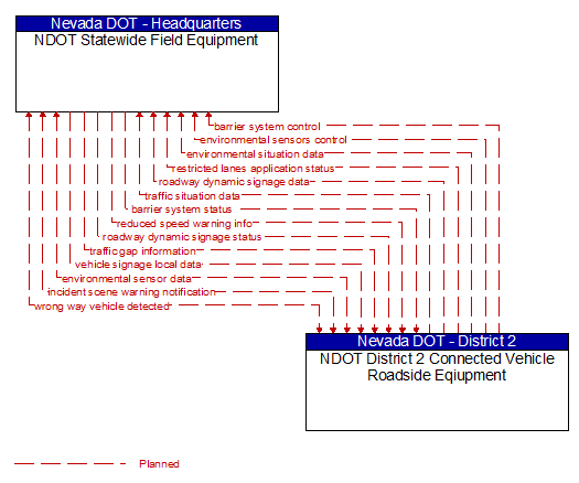
Interface: NDOT Statewide Field Equipment - NDOT District 2 Connected Vehicle Roadside Eqiupment
Architecture Flow Definitions
barrier system control (Planned) Applicable ITS Standards
Information used to configure and control barrier systems that are represented by gates, barriers and other automated or remotely controlled systems used to manage entry to roadways.
barrier system status (Planned) Applicable ITS Standards
Current operating status of barrier systems. Barrier systems represent gates, barriers and other automated or remotely controlled systems used to manage entry to roadways. Status of the systems includes operating condition and current operational state.
environmental sensor data (Planned) Applicable ITS Standards
Current road conditions (e.g., surface temperature, subsurface temperature, moisture, icing, treatment status) and surface weather conditions (e.g., air temperature, wind speed, precipitation, visibility) as measured and reported by fixed and/or mobile environmental sensors. Operational status of the sensors is also included.
environmental sensors control (Planned) Applicable ITS Standards
Data used to configure and control environmental sensors.
environmental situation data (Planned) Applicable ITS Standards
Aggregated and filtered vehicle environmental data collected from vehicle safety and convenience systems including measured air temperature, exterior light status, wiper status, sun sensor status, rain sensor status, traction control status, anti–lock brake status, and other collected vehicle system status and sensor information. This information flow represents the aggregated and filtered environmental data sets that are provided by the RSE to the back office center. Depending on the RSE configuration and implementation, the data set may also include environmental sensor station data collected by the RSE.
incident scene warning notification (Planned) Applicable ITS Standards
Notification of an incident scene emergency or safety issue. This flow identifies that an incident scene emergency or safety issue has occurred so that warnings may be generated by more than one system in the work zone.
reduced speed warning info (Planned) Applicable ITS Standards
Real time notification of vehicle detections, measured vehicle characteristics (e.g., vehicle height), speed measurements, and warnings issued by roadway infrastructure. This flow can also include roadway configuration data, current speed limits, and warning parameters and thresholds enabling local speed management application configuration and management.
restricted lanes application status (Planned) Applicable ITS Standards
Current RSE application status that is monitored by the back office center including the operational state of the RSE, current configuration parameters, and a log of lane use (aggregate profiles of vehicles that checked in to the lane and reported vehicle speeds in the lanes) and RSE communications activity.
roadway dynamic signage data (Planned) Applicable ITS Standards
Information used to initialize, configure, and control dynamic message signs. This flow can provide message content and delivery attributes, local message store maintenance requests, control mode commands, status queries, and all other commands and associated parameters that support remote management of these systems.
roadway dynamic signage status (Planned) Applicable ITS Standards
Current operating status of dynamic message signs, highway advisory radios, or other configurable field equipment that provides dynamic information to the driver.
traffic gap information (Planned) Applicable ITS Standards
Measured gap to the next approaching vehicle per lane and direction of travel
traffic situation data (Planned) Applicable ITS Standards
Current, aggregate traffic data collected from connected vehicles that can be used to supplement or replace information collected by roadside traffic detectors. It includes raw and/or processed reported vehicle speeds, counts, and other derived measures. Raw and/or filtered vehicle control events may also be included to support incident detection.
vehicle signage local data (Planned) Applicable ITS Standards
Information provided by adjacent field equipment to support in–vehicle signing of dynamic information that is currently being displayed to passing drivers. This includes the dynamic information (e.g., current signal states, grade crossing information, local traffic and road conditions, detours, advisories, parking availability, etc.) and control parameters that identify the desired timing, duration, and priority of the signage data.
wrong way vehicle detected (Planned)
Notification that a vehicle has been detected traveling in the wrong direction. This can be a direct report by an equipped vehicle that is being driven in the wrong direction or a report of a non–equipped vehicle that has been detected traveling in the wrong direction. It includes the current location, speed, acceleration, and heading of the wrong way vehicle.