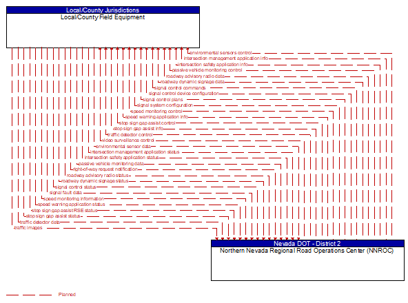
Interface: Local/County Field Equipment - Northern Nevada Regional Road Operations Center (NNROC)
Architecture Flow Definitions
environmental sensor data (Planned) Applicable ITS Standards
Current road conditions (e.g., surface temperature, subsurface temperature, moisture, icing, treatment status) and surface weather conditions (e.g., air temperature, wind speed, precipitation, visibility) as measured and reported by fixed and/or mobile environmental sensors. Operational status of the sensors is also included.
environmental sensors control (Planned) Applicable ITS Standards
Data used to configure and control environmental sensors.
intersection management application info (Planned) Applicable ITS Standards
Intersection and device configuration data, including intersection geometry, and warning parameters and thresholds. This flow also supports remote control of the application so the application can be taken offline, reset, or restarted.
intersection management application status (Planned) Applicable ITS Standards
Infrastructure application status reported by the RSE. This includes current operational state and status of the RSE and a log of operations.
intersection safety application info (Planned) Applicable ITS Standards
Intersection and device configuration data, including intersection geometry, and warning parameters and thresholds. This flow also supports remote control of the application so the application can be taken offline, reset, or restarted.
intersection safety application status (Planned) Applicable ITS Standards
Infrastructure safety application status reported by the RSE. This includes current operational state and status of the RSE and a record of intersection safety issues identified and alerts and warnings issued.
passive vehicle monitoring control (Planned) Applicable ITS Standards
Control commands used to control detection systems that rely on infrastructure–based identification of individual vehicles to measure travel times and other related measures by identifying the same vehicle at different points in the network. Related technologies include bluetooth readers and license plate recognition systems.
passive vehicle monitoring data (Planned) Applicable ITS Standards
Time stamped identifiers that identify the vehicles that have passed through a detection zone.
right-of-way request notification (Planned) Applicable ITS Standards
Notice that a request has occurred for signal prioritization, signal preemption, pedestrian call, multi–modal crossing activation, or other source for right–of–way.
roadway advisory radio data (Planned) Applicable ITS Standards
Information used to initialize, configure, and control roadside highway advisory radio. This flow can provide message content and delivery attributes, local message store maintenance requests, control mode commands, status queries, and all other commands and associated parameters that support remote management of these systems.
roadway advisory radio status (Planned) Applicable ITS Standards
Current operating status of highway advisory radios.
roadway dynamic signage data (Planned) Applicable ITS Standards
Information used to initialize, configure, and control dynamic message signs. This flow can provide message content and delivery attributes, local message store maintenance requests, control mode commands, status queries, and all other commands and associated parameters that support remote management of these systems.
roadway dynamic signage status (Planned) Applicable ITS Standards
Current operating status of dynamic message signs, highway advisory radios, or other configurable field equipment that provides dynamic information to the driver.
signal control commands (Planned) Applicable ITS Standards
Control of traffic signal controllers or field masters including clock synchronization.
signal control device configuration (Planned) Applicable ITS Standards
Data used to configure traffic signal control equipment including local controllers and system masters.
signal control plans (Planned) Applicable ITS Standards
Traffic signal timing parameters including minimum green time and interval durations for basic operation and cycle length, splits, offset, phase sequence, etc. for coordinated systems.
signal control status (Planned) Applicable ITS Standards
Operational and status data of traffic signal control equipment including operating condition and current indications.
signal fault data (Planned) Applicable ITS Standards
Faults reported by traffic signal control equipment.
signal system configuration (Planned) Applicable ITS Standards
Data used to configure traffic signal systems including configuring control sections and mode of operation (time based or traffic responsive).
speed monitoring control (Planned) Applicable ITS Standards
Information used to configure and control automated speed monitoring, speed warning, and speed enforcement systems.
speed monitoring information (Planned) Applicable ITS Standards
System status including current operational state and logged information including measured speeds, warning messages displayed, and violation records.
speed warning application info (Planned) Applicable ITS Standards
Roadway configuration data, current speed limits including time of day, week, or season speed limits as necessary, and warning parameters and thresholds. This flow also supports remote control of the application so the application can be taken offline, reset, or restarted.
speed warning application status (Planned) Applicable ITS Standards
Speed warning application status reported by the RSE. This includes current operational state and status of the RSE and a record of measured vehicle speeds and notifications, alerts, and warnings issued.
stop sign gap assist control (Planned) Applicable ITS Standards
Configuration and control of detectors that monitor traffic on the major road and signs that provide stop sign gap assist alerts and warnings to vehicles on the minor road.
stop sign gap assist info (Planned) Applicable ITS Standards
Intersection and device configuration data and warning parameters and thresholds for the stop sign gap assist application. This flow also supports remote control of the application so the application can be taken offline, reset, or restarted.
stop sign gap assist RSE status (Planned) Applicable ITS Standards
Stop sign gap assist application status. This includes current operational state and status of the RSE and a log of stop sign gap assist events including alerts and warnings issued.
stop sign gap assist status (Planned) Applicable ITS Standards
The current operational state and status of the field controller, sensors, and signs that support the stop sign gap assist application.
traffic detector control (Planned) Applicable ITS Standards
Information used to configure and control traffic detector systems such as inductive loop detectors and machine vision sensors.
traffic detector data (Planned) Applicable ITS Standards
Raw and/or processed traffic detector data which allows derivation of traffic flow variables (e.g., speed, volume, and density measures) and associated information (e.g., congestion, potential incidents). This flow includes the traffic data and the operational status of the traffic sensor system.
traffic images (Planned) Applicable ITS Standards
High fidelity, real–time traffic images suitable for surveillance monitoring by the operator or for use in machine vision applications. This flow includes the images and meta data that describes the images.
video surveillance control (Planned) Applicable ITS Standards
Information used to configure and control video surveillance systems.